
Rhodium Plated Brass

Oldham W390 S400 E400 N410
Print With Shapeways
 Choose Your Material
 Choose your color and finish
$1,275.52
Have a question about this product?
contact the designerYou must be logged in and verified to contact the designer.
Product Description
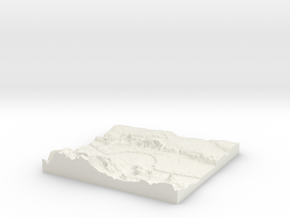
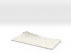
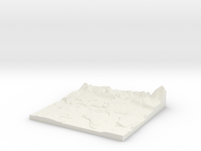
3D Landscape Relief model of Oldham.
Centred on the towns and villages of Lees, Austerlands, Grotton, Pitses, Moorside, Scouthead, Alt, Oldham, Grasscroft, Park Bridge, Besom Hill, Heyside, Chadderton, Clough, Grains Bar, Long Sight, Thurston Clough, Crompton Fold, Shaw, Uppermill, Greenfield, Bardsley, Hazelhurst, Luzley, Dobcross, Mossley, Royton, Delph, New Delph, Chadderton Fold, Slackcote, Carrbrook, Summit and Woodhouses.
All areas of United Kingdom available in any size, scale and with any vertical scaling to emphasise the terrain to best affect.
The W S E and N numbers in the title show the Western, Southern, Eastern and Northernmost limits of the area in terms of the Ordnance Survey grid reference in kilometres.
Details
What's in the box:
W390 S400 E400 N410 Oldham_fixed

Dimensions:
Success Rate:
First To try.
What's this?
Rating:
Mature audiences only.

