

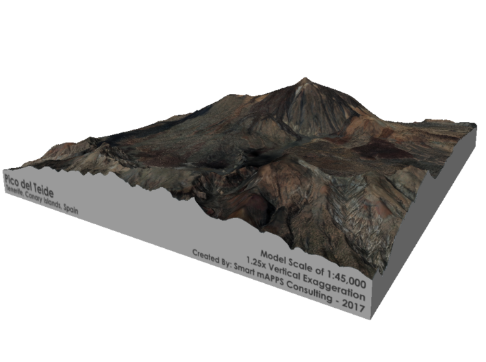

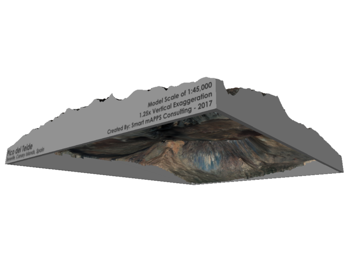


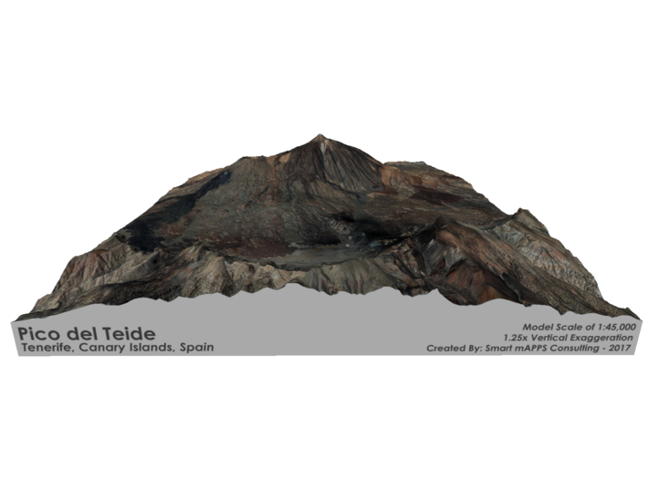


Pico del Teide Map, 1:45,000
Made by
Print With Shapeways
 Choose Your Material
 Choose your color and finish
$447.02
Have a question about this product?
contact the designerYou must be logged in and verified to contact the designer.
Product Description
Interactive 3D Viewer
If you would like a custom relief map, contact me through my website or through Shapeways.
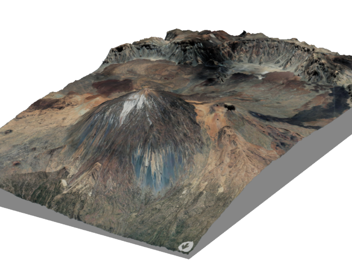
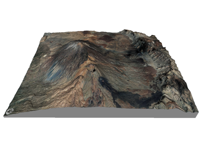
Mount Teide (Spanish: Pico del Teide, pronounced: [ˈpiko ðel ˈtei̯ðe], "Teide Peak") is a volcano on Tenerife in the Canary Islands, Spain. Its 3,718-metre (12,198 ft) summit is the highest point in Spain and the highest point above sea level in the islands of the Atlantic.If measured from the ocean floor, it is at 7,500 m (24,600 ft) the highest volcano in the world base-to-peak outside of the Hawaiian Islands.[a][5] Its elevation makes Tenerife the tenth highest island in the world. It remains active: its most recent eruption occurred in 1909 from the El Chinyero vent on the northwestern Santiago rift. The United Nations Committee for Disaster Mitigation designated Teide a Decade Volcano[6] because of its history of destructive eruptions and its proximity to several large towns, of which the closest are Garachico, Icod de los Vinos and Puerto de la Cruz. Teide, Pico Viejo and Montaña Blanca form the Central Volcanic Complex of Tenerife.
The volcano and its surroundings comprise Teide National Park, which has an area of 18,900 hectares (47,000 acres) and was named a World Heritage Site by UNESCO on June 28, 2007.[7] Teide is the most visited natural wonder of Spain, the most visited national park in Spain and Europe and – by 2015 – the eighth most visited in the world,[8] with some 3 million visitors yearly.[9] A major international astronomical observatory is located on the slopes of the mountain.
Source: Wikipedia
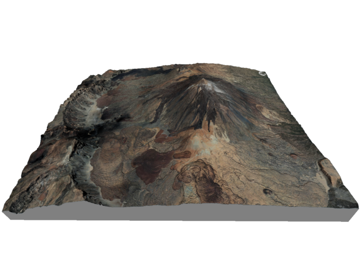
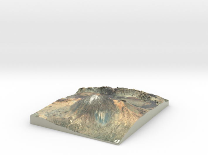
The model is created at a scale of 1:45,000 with 1.25x vertical exaggeration. It features a built-in base, so it sits perfectly on a desk or in a frame.
Model Data Sources: Instituto Geográfico Nacional (IGN)
If you would like a custom relief map, contact me through my website or through Shapeways.
Mount Teide (Spanish: Pico del Teide, pronounced: [ˈpiko ðel ˈtei̯ðe], "Teide Peak") is a volcano on Tenerife in the Canary Islands, Spain. Its 3,718-metre (12,198 ft) summit is the highest point in Spain and the highest point above sea level in the islands of the Atlantic.If measured from the ocean floor, it is at 7,500 m (24,600 ft) the highest volcano in the world base-to-peak outside of the Hawaiian Islands.[a][5] Its elevation makes Tenerife the tenth highest island in the world. It remains active: its most recent eruption occurred in 1909 from the El Chinyero vent on the northwestern Santiago rift. The United Nations Committee for Disaster Mitigation designated Teide a Decade Volcano[6] because of its history of destructive eruptions and its proximity to several large towns, of which the closest are Garachico, Icod de los Vinos and Puerto de la Cruz. Teide, Pico Viejo and Montaña Blanca form the Central Volcanic Complex of Tenerife.
The volcano and its surroundings comprise Teide National Park, which has an area of 18,900 hectares (47,000 acres) and was named a World Heritage Site by UNESCO on June 28, 2007.[7] Teide is the most visited natural wonder of Spain, the most visited national park in Spain and Europe and – by 2015 – the eighth most visited in the world,[8] with some 3 million visitors yearly.[9] A major international astronomical observatory is located on the slopes of the mountain.
Source: Wikipedia
The model is created at a scale of 1:45,000 with 1.25x vertical exaggeration. It features a built-in base, so it sits perfectly on a desk or in a frame.
Model Data Sources: Instituto Geográfico Nacional (IGN)
Details
What's in the box:
Pico-9.8x12

Dimensions:
Success Rate:
First To try.
What's this?
Rating:
Mature audiences only.


