Tan Fine Detail Plastic

Torbay W286 S45 E296 N69
Print With Shapeways
 Choose Your Material
 Choose your color and finish
$44.89
Have a question about this product?
contact the designerYou must be logged in and verified to contact the designer.
Product Description
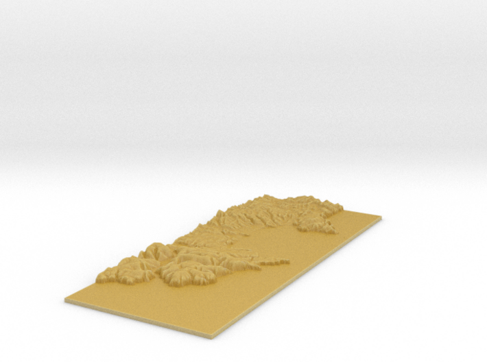
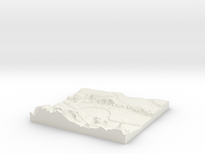
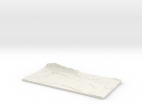
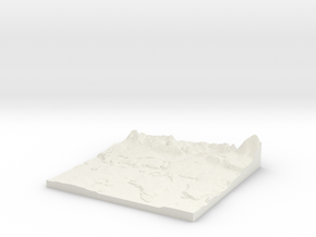
3D Terrain Relief model of Torbay on the English Riviera.
Centred on the towns and villages of Churston Ferrers, Brixham, Galmpton, Higher Brixham, Goodrington, Hillhead, Waddeton, Woodhuish, Paignton, Boohay, Yalberton, Dittisham, Preston, Hollicombe, Collaton St Mary, Torquay, Cockington, Kingswear, Dartmouth, Westerland, Babbacombe, Warfleet, St Marychurch, Barton, Shiphay, Coombe Pafford, Marldon, Watcombe, Eginswell, Daccombe, Compton, Stoke Fleming, Maidencombe, North Whilborough and Coffinswell.
All areas of United Kingdom available in any size, scale and with any vertical scaling to emphasise the terrain to best effect.
The W S E and N numbers in the title show the Western, Southern, Eastern and Northernmost limits of the area in terms of the Ordnance Survey grid reference in kilometres.
Details
What's in the box:
W286 S45 E296 N69 Torbay_fixed

Dimensions:
Success Rate:
First To try.
What's this?
Rating:
Mature audiences only.

