

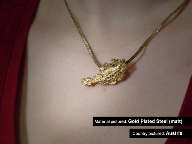
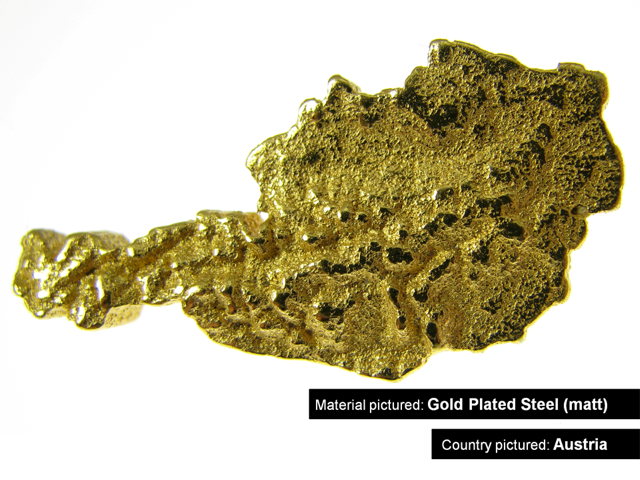
The Society for Printable Geography creates jewelry and puzzles using real satellite data.

The GeoBling series of jewelry started in 2011 by the Society for
Printable Geography uses data from NASA’s Shuttle Radar Topography
mission to create artifacts resembling the countries of the world with
realistic terrain information. Using complex algorithms created by
computational geometry and geodata The Society for Printable Geography can create a custom piece of
jewelry for almost any country in the world within seconds.


For more information visit The Society for Printable Geography’s website.
Fluid forms does it better…
http://www.Fluid-forms.com
As a member of fluid forms…
I second that,
Thanks danz
Danz and John,
Being a big fan of Fluid Forms and as of recently Shapeways’ geographical jewelry, I have to say that your talking negatively about a service that offers similar products as a means of promoting your own business is despicable.
You should give these people some credit, the models shown in the photographs look really cool! On http://www.fluid-forms.com I can’t even find any jewelry for the countries of the world, never mind in steel or gold plated. And the small silver pendant of Styra that Fluid Forms offer is four times the price of equivalent silver country shapes available on Shapeway (follow the link in the post to see)!
Again, I love Fluid Forms and find their products beyond cool, but coming over here and and making unfounded claims about inferior quality of non-competing products is nothing more than a sign of bad morals.
Hi Herb,
Thanks for replying. I agree with your interjection.
The work is really nice and like the concept.
USGS has some great information and love all the projects that come out of it.
http://www.flickr.com/photos/hirmes/sets/72157628974394823/
I hope people make and share more map projects in the future…